This research was conducted primarily by Diana B. Please cite her when referencing this work!

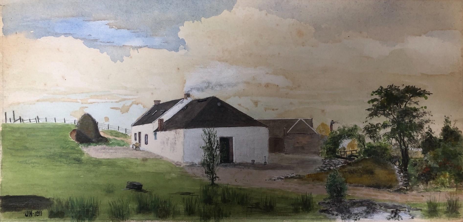
Machrie Moor on the isle of Arran is a unique archaeological site, famous for its standing stones, cairns, stone circles and other historic remains. But visitors often wander away from the ancient stones, drawn by a semi-derelict little farm house that lies in a dip in the landscape and gives its name to the Moss Farm Road stone circles.
The settlement nearest to Moss Farm is Tormore, on the road between Blackwaterfoot and Lochranza, and earlier maps show a number of smallholdings surrounding Tormore on the west side of the road. On the east side, about 1.74k (1.06 miles) from the road, lies Moss Farm, in an area called Sliabh nan Carraigean (Gaelic ‘slope of the little crags’). A second single building once lay further east on a smallholding which followed the southerly contours of Machrie Water1. Probably another farm, it is unnamed on all the OS maps and had disaappeared by 1915.
The Duke of Hamilton was the feudal superior for much if not all of the property in Tormore and surrounding area, including Moss Farm.
Little written information on Moss Farm is available. Part of the problem in identifying its history comes from names, human and locational. Without names/numbers for the smallholdings and names for their individual tenants, it has to date proved imposssible to find who lived in Moss Farm in earlier times. The same surnames occur repeatedly – McKenzie, Currie and McKillop are particularly well represented and reflect the closeness of the community. There was also a tradition of leaving at least smaller properties without recorded names. Only in the late 19th century did house names start to appear, usually in English rather than Gaelic – Rowanpark, Ashgrove, Millhill.
Census records exist from 1841 onwards but they present their own problems. Taking the 1861 census as an example, Tormore, including Tormore Farm, comprised 19 households, mostly with a farmer as the head and with no geographical clues as to location2. In 1891, every property in Tormore was described as Tormore Farm House, with the exception of two cottar’s houses. The occupier of the main farmhouse may have done all the census paperwork with the enumerator, without troubling the smaller tenants3.
Only the OS maps can be relied on to give a definite fix on Moss Farm’s location, and the area was surveyed in 1864 and 1914, and the maps revised in 1895 and 1915. See (Argyll and Buteshire) series CCXVIII 6” and 25”.
Unnamed croft, Machrie Moor – Argyll & Buteshire CCXLVIII.8 25” series surveyed 1864 and published 1867The same edition shows two (also unnamed) buildings on the site shown below which later maps identify as Moss Farm. Directly to the north are two enclosures, one surrounded by bushes, perhaps to keep grazing animals off a vegetable patch.
Moss Farm, Machrie Moor – Buteshire CCXLVIII.8 25” series revised 1895 and published 18964The first likely written sighting of Moss Farm comes in 1872 in the Ardrossan & Saltcoats Herald, when Angus McKillop, “ploughman to Peter McKenzie, Tormore Moss”, won a prize in the junior class of a ploughing match on 20th April 1872. He went on to win again in the Arran Cattle Show in August 18815. But the first actual mention of Moss Farm by that name comes with the death of Archibald Robertson, blacksmith, on 22nd June 1899, as reported by his brother, William Robertson, who was present at the time6.
![Undated postcard of the Machrie Moor standing stones, Moss Farm in the distance [Image: Paul Burns]](/moss-farm/standing-stones.jpg)
Moving forward several decades, the Robertsons are still in occupation at Moss Farm in 1934, advertising in The Scotsman holiday lets at various properties in the area7. The farmhouse had no electricity or running water, and sanitation was a crude arrangement in the neighbouring field, but this was presumably acceptable in a country holiday house. It remained that way until the final tenant moved out in the 1960s, and the old house began to deteriorate.
-
Ordnance Survey (1867) Kilmory Island of Arran 1:2,500 Sheet CCXLV111.8 Available at https://maps.nls.uk/view/75118758 Accessed 3 June 2025 ↩︎
-
1861 Tormore Kilmory Bute RD 554 ED 7 ↩︎
-
1891 Tormore Kilmory Bute RD 554 ED 7 ↩︎
-
Pub. 09 March 1872 Ardrossan and Saltcoats Herald The Arran Farmers’ Society p 4 ↩︎
-
Pub. 20 August 1881 Ardrossan and Saltcoats Herald The Arran Cattle Show pp 3,4 ↩︎
-
‘Archibald Robertson’ (1899) Certified copy of death certificate for Archibald Robertson 22 July 1899 Shiskine, Bute ↩︎
-
Pub. 05 May 1934 The Scotsman Accommodation p 19 ↩︎